
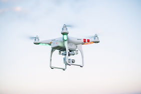
Alberta Drone Mapping, LiDAR & Environmental Services
In the ever-evolving technological landscape, Aeria Solutions stands out as the premier provider of drone services in Alberta. With specialized offerings such as detailed site assessments, precise environmental surveys, and advanced remote sensing solutions, we are committed to delivering more than just satisfactory results. Our team focuses on accuracy, speed, and quality, ensuring that your projects receive the highest level of service and attention to detail.
Precision Drone Mapping in Alberta
Our drone mapping services in Alberta are designed to provide high-resolution, accurate images and maps that are perfect for your project needs. From topographic maps and Ortho mosaic maps to 3D models, Aeria Solutions ensures that your mapping requirements are met with the highest level of accuracy. When you work with us, you can trust that your mapping needs are in expert hands, allowing you to focus on your creative vision and project execution.
Accurate Drone Lidar for Topography & Infrastructure Projects in Alberta
LiDAR (Light Detection and Ranging) is an advanced technology used to capture and analyze spatial data with exceptional accuracy. Our drone LiDAR services in Alberta are ideal for obtaining precise topographical information, including elevation data of regions and structures. This technology is particularly useful for forestry operations, construction projects, and flood risk assessments. With Aeria Solutions, you’ll receive the data clarity necessary to make sound decisions and achieve your project goals.
Environmental Assessment & Monitoring via Drone Solutions in Alberta
At Aeria Solutions, environmental conservation and sustainability are top priorities. Our Alberta drone services are designed to promote sustainable land management practices. Whether it's species tracking, plant health analysis, or broader environmental studies, our drones provide the crucial data needed to preserve Alberta's natural beauty. Partner with us to ensure that your projects are both environmentally responsible and cost-effective.
Accurate and Efficient Drone Survey in Alberta
Surveys are an essential component of any project, and Aeria Solutions provides highly accurate and efficient drone survey services in Alberta. Our drones help gather critical data for topographic surveys, land development, and infrastructure planning. By choosing Aeria Solutions, you gain access to faster, more accurate survey results, reducing project timelines while maintaining top-notch quality at competitive prices.
Contact Us Today
Aeria Solutions is Alberta's trusted source for comprehensive drone services. Whether you require geographic information systems (GIS), mapping, remote sensing, LiDAR, environmental services, or surveying, we provide value-added solutions that ensure precision, efficiency, and practicality. No matter if you're a business or a government agency, Aeria Solutions tailors solutions to meet your specific needs. Contact us today and let us show you how our affordable, high-quality drone services can take your projects to new heights.
