
Canada Drone LiDAR Services
At Aeria Solutions, we offer cutting-edge Drone LiDAR services that provide precise and reliable data for industries across Canada. Our advanced LiDAR technology, combined with drone capabilities, allows us to capture high-resolution 3D mapping and surveying data, ensuring that your projects are completed with the highest level of accuracy and efficiency.
What is Drone LiDAR?
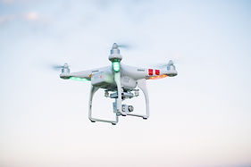
Drone LiDAR (Light Detection and Ranging) is an innovative technology that uses laser pulses to measure distances and create highly detailed 3D models of the Earth's surface. By integrating LiDAR with drones, we can quickly capture vast amounts of data from hard-to-reach areas, providing a level of precision that traditional surveying methods cannot match. This powerful tool is perfect for mapping landscapes, analyzing infrastructure, and conducting topographical surveys.
Why Choose Our Canada Drone LiDAR Experts?
-
Unmatched Precision: Our Drone LiDAR services provide highly accurate data that allows for the creation of detailed 3D models, maps, and topographic surveys.
-
Efficiency: Using drones equipped with LiDAR technology enables us to cover large areas in a fraction of the time it would take with traditional surveying methods, helping you save time and reduce costs.
-
Cost-Effective: Our drone-based LiDAR services are a more affordable solution compared to conventional methods, without compromising on data quality or accuracy.
Applications of Drone LiDAR in Canada
1. Topographic Mapping: Create precise, high-resolution maps for land use planning, infrastructure development, and more.
2. Construction and Engineering: Gather data for site preparation, design, and project monitoring.
3. Environmental Monitoring: Monitor forest health, assess flood risks, and manage natural resources.
Get Started with Aeria Solutions
Unlock the power of Drone LiDAR with Aeria Solutions in Canada. Our expert team is ready to deliver the most accurate, efficient, and cost-effective data collection solutions tailored to your project’s needs. Whether you're in construction, land surveying, or environmental monitoring, we have the tools and expertise to make your vision a reality.
