
Remote Sensing, Simplified: Air, Land & Sea
Mapping & Surveying
Precise geospatial intelligence from every angle
Mapping and surveying form the foundation of informed decision-making. Whether you're planning construction, monitoring environmental change, assessing infrastructure, or documenting site conditions, you need data you can trust - accurate, comprehensive, and delivered in formats that integrate with your existing workflows.
We deploy aerial, surface, and ground-based systems to capture geospatial data meeting engineering-grade standards. Our strength is integration: pulling multiple sensors and platforms into unified workflows that produce complete, defensible results.
LiDAR Scanning Services
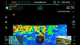
LiDAR (Light Detection and Ranging) uses laser pulses to measure distances with millimeter precision, creating detailed 3D representations of terrain and structures.
Our aerial LiDAR systems capture high-resolution terrain models with dense point clouds accurately representing ground elevation even under vegetation canopy. Structural analysis data provides detailed 3D models of buildings, infrastructure, and industrial facilities for engineering assessment. Change detection datasets from repeat surveys quantify erosion, subsidence, stockpile volumes, and terrain modification over time. LiDAR data integrates directly with CAD and GIS systems, supporting engineering design, environmental assessment, and regulatory compliance.
Aerial Photogrammetry and 3D Modelling
Photogrammetry transforms overlapping aerial photographs into measurable products: orthomosaics, digital surface models, and 3D reconstructions.
Orthomosaics are geometrically corrected aerial maps that can be measured directly - distances, areas, and positions are accurate across the entire image. Digital Elevation Models (DEM) provide elevation data for every point in your survey area, supporting drainage analysis, grading calculations, and terrain visualization. Digital Surface Models (DSM) include features like buildings, vegetation, and structures - essential for visibility analysis and planning. 3D models and digital twins deliver detailed reconstructions for engineering visualization, heritage documentation, and structural assessment.
Bathymetric Mapping and SONAR
Our capabilities extend mapping below the waterline. We deploy single-beam and side-scan sonar systems to capture bathymetric data for hydrological studies, dredging planning, and aquatic habitat assessment.
Custom-built systems enable seamless above-and-below-water mapping - combining aerial LiDAR with underwater sonar into unified datasets.
Acoustic Doppler Current Profilers (ADCPs) are also used to provide water velocity and discharge data for hydrodynamic analysis.
Precision Ground Control and Survey Accuracy
Survey-grade accuracy requires ground truth. We deploy RTK (Real-Time Kinematic) and PPK (Post-Processed Kinematic) GNSS systems to establish ground control, ensuring your data meets rigorous accuracy requirements.
We work with you to define accuracy requirements before the project begins, then configure methods to meet them. Visualization grade serves marketing imagery and general site overview. Mapping grade supports planning, monitoring, environmental analysis, and general measurement. Survey grade delivers engineering design, legal surveys, construction layout, and regulatory compliance. High precision enables construction control, deformation monitoring, and precision measurement.
Deliverables and Data Formats
Data is only valuable if you can use it. We deliver in formats compatible with your existing software and workflows: GeoTIFF orthomosaics compatible with GIS platforms and CAD software, LAS/LAZ point clouds in industry-standard formats, DEM/DSM rasters ready for terrain analysis and volumetric calculations, 3D mesh models for visualization and engineering review, and CAD exports for AutoCAD, Civil 3D, or other design software.
Every delivery includes complete documentation: processing reports, accuracy assessments, coordinate system information, and README files explaining exactly what you're receiving.
Industry Applications
Our mapping and surveying capabilities support clients across sectors. Construction and development projects benefit from site documentation, progress monitoring, volume calculations, and as-built surveys. Environmental monitoring includes habitat mapping, erosion assessment, vegetation analysis, and baseline documentation. Resource sector applications cover mine site assessment, stockpile measurement, infrastructure inspection, and legacy site documentation. Infrastructure projects involve corridor mapping, structural assessment, and condition documentation for roads, utilities, and facilities. Marine and hydrological work encompasses bathymetric surveys, river discharge studies, and coastal mapping.